|
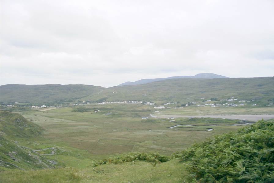
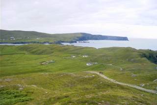
Long view of the villageThe village is rather spread out: a main street with some houses, the Catholic church, the three pubs, and a few shops. The bulk of the houses (mainly bungalows) are then thinly spread for a couple of miles around. The top of Sliabh Liag can be seen in the background. |
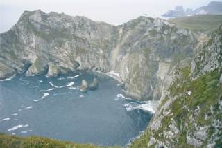 |
The cliffs by Glen HeadThe coastline in the area is incredibly spectacular, as these next few shots show. This one is from the top of Glen Head, the headland on the north side of the Glen. |
 |
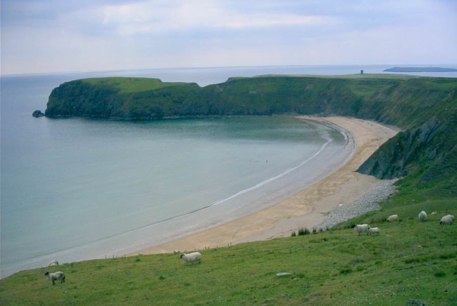
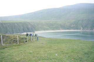
An Tra Ban (the Silver Strand)This lovely beach is a few miles beyond the village of Gleann Cholm Cille, at Máilinn Bhig (Malin Beg). In the distance is part of Reachlainn Uí Bhirn (Rathlin O'Birne Island); you can also see one of the signal towers from the time of the Napoleonic wars beyond the headland (more about these later). The headland on the far side of the beach is the site of a 2000-year old promontory fort.
|
 |
Tra Ban from the fortLooking back to Tra Ban from the promontory fort, with Leahan (427m) in the background. The fort is an excellent place for watching sea birds, which nest on the rocks below. It is a great site for a fort: the path narrows to about 3m wide at the entrance, with sheer drops to the rocks and sea on either side.
|
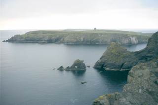 |
West of Tra BanThe view looking west along the coast from the promontory fort. The signal tower is now quite prominent.
|
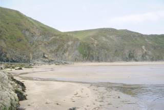 |
The beach at Tra BanYet another shot of the beach - but it is a lovely place! The weather wasn't great on the day I took this, also it was a Sunday morning, which partly explains the lack of people. The 165 steps down (and back up) to the car park also has some impact.
|
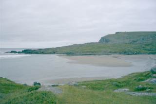 |
Glen BayAren't the beaches nice? This one is Glen Bay, the main beach in the village. I'm told you can swim around here, but it's quite cool in. I limited myself to a decent paddle at Tra Ban this year, but if the sun had shone I really would have gone swimming, honest. Apparently the currents can be quite treacherous though, especially here.(Spot the signal tower on the top of Glen Head)
|
 |
Glen Bay from the NorthShot taken from the path up to Glen Head.
|
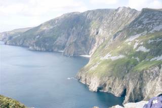 |
Sliabh LiagThe cliffs at Sliabh Liag (Slieve League) a few miles from the village. These are the highest sea-cliffs in Europe, 595m high, a photo can't do them justice. The shot was taken from a little way above the upper car park at the Bunglas cliffs. Time and weather prevented a proper walk right the way along - next year maybe? This and the next few shots were taken when the Environment course went for a walk part of the way up the cliffs.
|
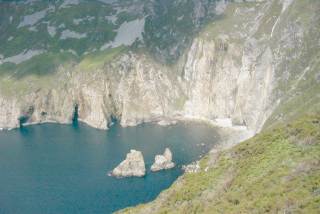 |
The Giants's chair and tableA bay at the base of Sliabh Liag: the two rocks in the sea are called the Giant's chair and table.
|
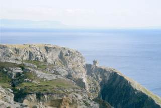 |
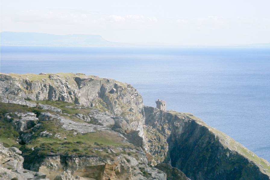
The Bunglas signal towerBunglas is the name of the cliffs below Sliabh Liag where wimps can park their cars. Here is another of the chain of signal towers that dot the coastline.
|
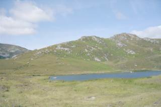 |
Lough O'MulliganA rather lovely little lough on the way back down from Bunglas.
|
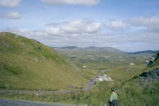 |
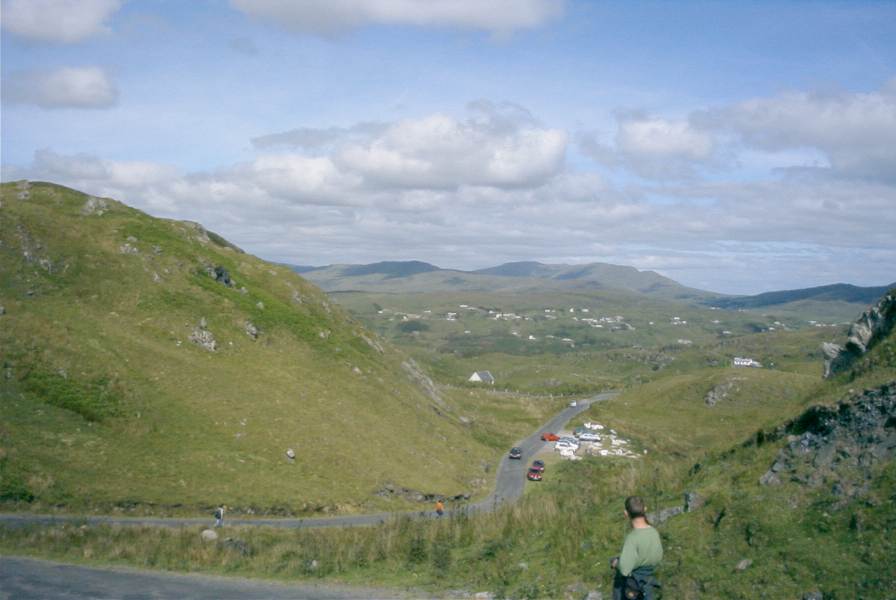
TeileannThe view along the road from Bunglas walking back down to Teileann (Teelin).
|